The historic county of Yorkshire packs in some fantastic and varied walking country. The A-Z Adventure Atlases now map some of the finest walking areas in Yorkshire, with map books covering the Yorkshire Dales South, the North York Moors East and West, the Peak District’s Dark Peak, the Pennine Way South and the Coast to Coast Walk. This week, we’ve picked out a few of the best Yorkshire walks we know. Read on and see if any of these tempt you out to dale or moor.
Malham to Horton-in-Ribblesdale (24 km / 15 miles)
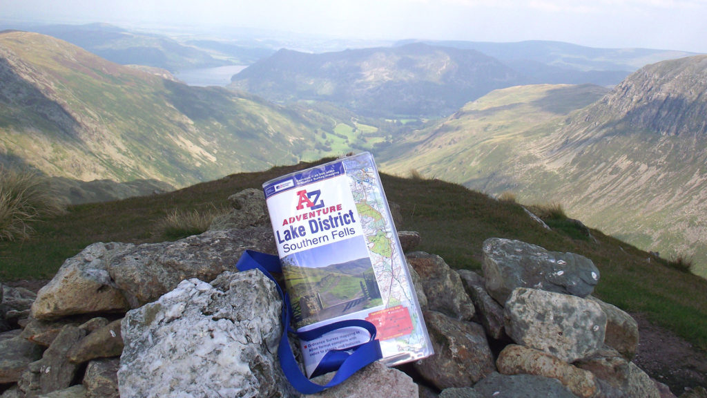
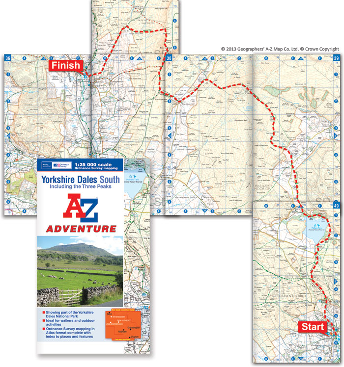
Britain’s oldest National Trail, the 268 mile Pennine Way is a notorious challenge to walk in full. Several thousand still do each year, and are rewarded with the outstanding scenery (weather-permitting) of the “backbone of England”. For anyone wanting to dip into the trail, or who finds a full day of hiking is plenty enough of an achievement, the Malham to Horton section is a stand-out Yorkshire walk. This popular day walk is served by public transport, parking and accommodation at either end, giving you various options for transport and overnight stays. The first section takes in the fascinating limestone scenery of Malham Cove and Watlowes beyond. After a lakeside detour past Malham Tarn, the route soon heads out into wilder country, climbing to the vantage points of Fountains Fell and then Pen-y-ghent. It finally drops down into Horton-in-Ribblesdale to complete one of the best Yorkshire walks.

The route is also covered by the Yorkshire Dales South atlas.
Less-trodden alternative: Another classic day walk on the Pennine Way is the section from Hawes to Tan Hill. This takes in the long climb over Great Shunner Fell, peaking at 716m before dropping down into Thwaite in picturesque Upper Swaledale. A stroll through the valley is followed by the ascent up to the isolated Tan Hill Inn, the highest inn in the British Isles. The start and end points of this section are more remote from public transport, but the walk is quieter as a result.
Osmotherley and Cod Beck Reservoir (8 km / 5 miles)
The Coast to Coast Walk follows Swaledale on its dramatic course from the Irish Sea to the North Sea at Robin Hood’s Bay. Our next walk is in the area where the Coast to Coast-ers reach the North York Moors, and enjoy fine views back across the Vale of Mowbray. This varied circular walk could be started in Osmotherley or at the car park by Cod Beck Reservoir, depending on when you want to take your refreshment stops. Half the route follows the Cleveland Way, and the section up through Arncliffe Wood to Beacon Hill is also shared with the Coast to Coast Walk route.

Nearby classics: Sutton Bank is an understandably popular start point for walks in the Hambleton Hills. Explore from there to the White Horse of Kilburn, Gormire Lake and Byland Abbey. Further north in the Cleveland Hills, another of the best Yorkshire walks takes in Roseberry Topping and Captain Cook’s Monument from Great Ayton. These routes are all covered by the North York Moors West atlas.
Millstone Edge and Owler Tor (4 km / 3 miles)
The Peak District is the closest outdoor playground for South Yorkshire. The shortest walk we’ve picked is from the very southwest corner of Yorkshire, and crosses the boundary into Derbyshire. This circular walk starts from the car park on the A6187 east of Hathersage. A highlight of the walk is the dramatic view down from Millstone Edge into the Derwent Valley, which makes the trains running along the valley floor look like toys. The wide footpath from the car park to the viewpoint makes for a rewarding stroll for the mobility-impaired.

Rail alternative: the route can be extended slightly down the hill to start and finish at Grindleford station.
Please leave a comment with your own choices of the best Yorkshire walks.