Adventure Atlases

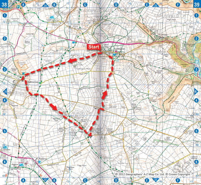
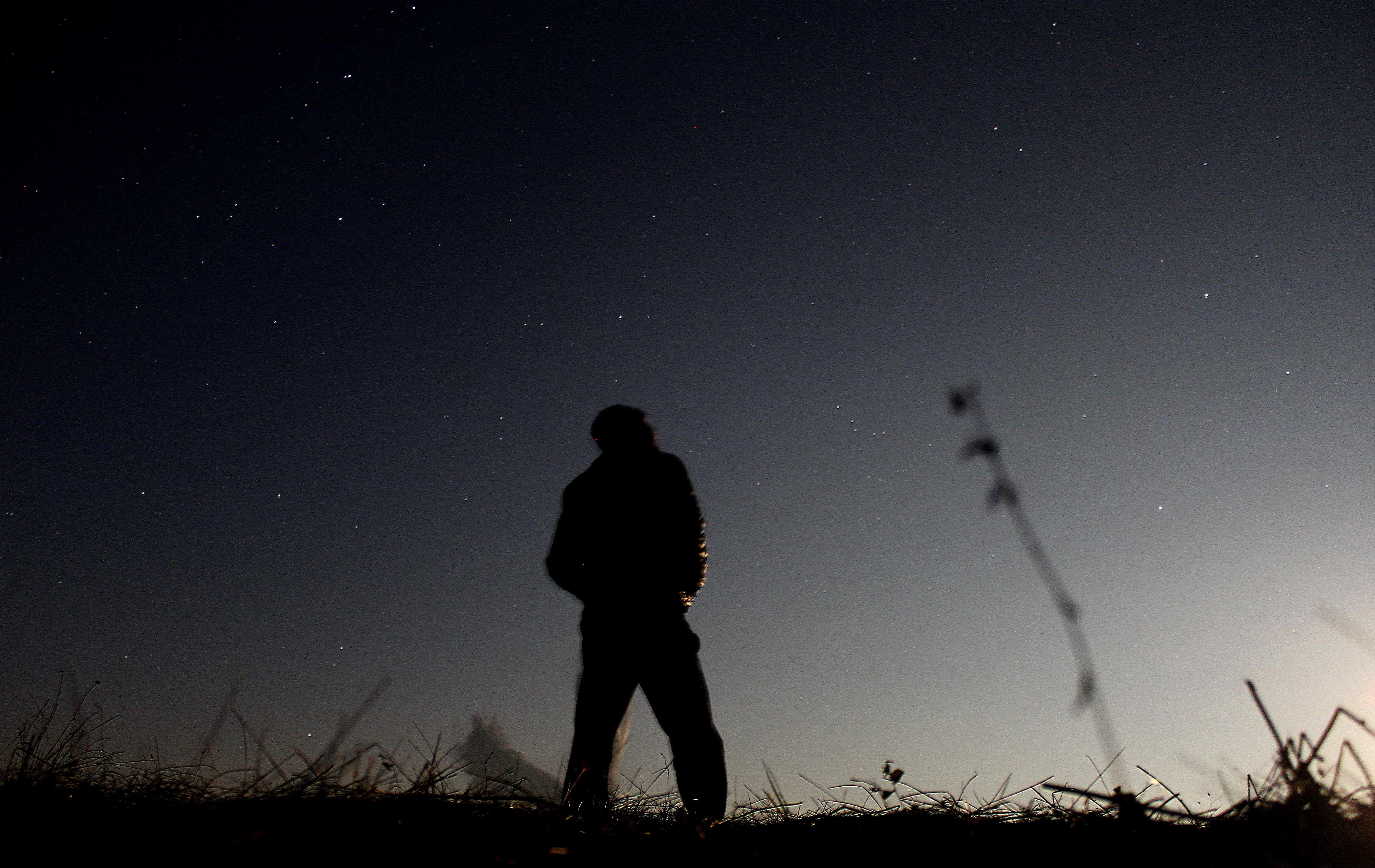
Peace, Quiet and Dark Skies

It’s that time of year again when the kids are off school for 6 weeks for the summer holidays and you’re wondering how on earth you are going to keep them entertained for all that time. Well here is a novel activity to keep them engrossed as the sunsets get… Read More

What if you could make your own atlas?

Would you like to design a new A-Z atlas? If you could, would it be a street atlas, road atlas, outdoor activities map or something else entirely? A-Z is always looking to develop useful new map products. Recent releases have been as varied as the Adventure Atlases, smartphone… Read More
Mountain Biking in the Brecon Beacons

Mountain Biking in the Brecon Beacons

The Brecon Beacons provide some of the wildest scenery in southern Britain. Despite sitting just above the South Wales Valleys, the windswept moorlands and lush valleys feel impressively remote. But it takes more than just mountains to make for great mountain biking. The Brecon Beacons National Park has plenty of… Read More
A-Z street mapping and Adventure Atlas mapping

What Is and Isn’t Shown on A-Z Maps

Have you ever noticed that your A-Z street map shows public toilets, speed cameras, postcode districts, and even house numbers on main roads? On the other hand, have you ever wondered why your A-Z doesn’t show height contours, roadworks or the outlines of pavements? You could probably think of a… Read More
Yorkshire Dales map - overview showing Yorkshire Three Peaks route

Yorkshire Three Peaks | Yorkshire Dales Map

The Yorkshire Dales National Park is a place of outstanding natural beauty. It is home to sublimely scenic valleys, remote rolling hills, and some interesting geology, including limestone pavement and large cave systems. The variety of landscapes makes it excellent walking country. The highest points in the Yorkshire Dales are… Read More

Guess the National Park Competition

It’s competition time! We’re giving you a chance to win an Adventure Atlas. A-Z Adventure Atlases have the accuracy and quality of OS Explorer mapping and are indexed within a single book, making them the perfect companion for walkers, off-road cyclists, horse riders and anyone wishing to explore this… Read More

The Broads

The Broads is a vast network of waterways in Norfolk and Suffolk, formed from seven connected rivers. The broads themselves are lakes formed from flooded medieval peat diggings, and are often found alongside the rivers. A national park covers 303 square kilometres, making it Britain’s largest protected wetland. The waterways… Read More

About the Adventure Atlas Series

The A-Z Adventure Atlases provide accurate and detailed OS Explorer mapping in a slim book format. Walkers and other off-road adventurers can now carry their Ordnance Survey (OS) mapping in a convenient single indexed book, rather than as a large sheet map. In this week’s blog, we explore this new… Read More
Chelmorton © Crown Copyright © 2012 Geographers' A-Z Map Co. Ltd.

Walking in the Peak District

Walking in the Peak District National Park can cater for many different tastes, with the contrasting landscapes of the White and Dark Peaks. It is easily accessible from Sheffield, Manchester and the Midlands and there is plenty for visitors to see. The contrast between quiet limestone dales and wild upland… Read More