With the largest of the Three Peaks done, things should be easy now….right?
Day Three – Scafell Pike, the second of the three peaks
Starting height: 120 metres above sea level
Car park grid reference: NY235122
A-Z Map reference: 5C 14 (1D 61)
Start time: 6:20am
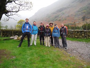 Day 3 started like a typical Lakeland day; wet and misty to start with the prospect of a little sunshine later in the day. We parked our cars at Seathwaite Farm, officially the wettest place in England. Armed with our Adventure atlases and weatherproof map cases we head south through the farm and up to Stockley bridge.
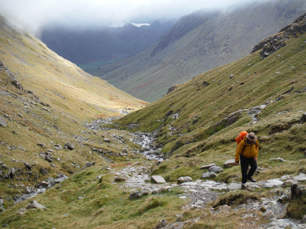
We’d already decided to take the Grains Gill route up to the Scafell massif instead of the more popular path alongside Lingmell Gill which most three peakers use due to its speed. The views are not as good, not that it mattered today though. The mist breaks occasionally just to give fleeting views behind us of the Borrowdale valley, Derwent Water and Keswick, up ahead is the imposing Great End.
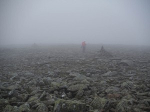 Our path takes us to the foot of this massive slab of rock and to a T-junction. Turn right and you’re led to Sprinkling Tarn and beyond that Great Gable. We go left and we’re quickly up to Esk Hause, a crossing point of two footpaths marked by a huge cairn, it’s clear to see where we go. We take a sharp right which heads up onto the Scafell massif itself and as we climb higher into the clouds visibility gets worse. This, coupled with the lack of any real footpath make navigation with map and compass much more important. Yes there are cairns to guide you, but these are easily missed in these conditions. After about a kilometre of messing around in the mist and plenty of boulder hopping on the moonscape type terrain the ground quickly falls away on all sides, this is not the summit however.
Depressingly, the real summit is a short sharp drop followed by a climb back up which borders on a grade 1 scramble. After a puff of the cheeks and a few more boulders to hop across, the summit cairn can finally be seen.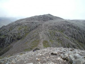
 We hit the windy, misty top at 9:15am, just in time for Hayley to go off to try and find the local conveniences, but there’s no gift shop and toilets on this mountain! It’s been two and a quarter hours since leaving soggy Seathwaite and up until now we’ve had the mountain to ourselves but now a steady trail of damp walkers joins us at the summit. All have come from Wast Water via the Lingmell Gill route and most are doing the 24 hour challenge, they don’t stay for long.
Scafell Pike isn’t a ‘pretty’ mountain top, especially in these conditions; it’s too cold and windy to stay for long. After a quick sausage roll and a battered banana it’s time to head down the same route as we’d come up. There was a short discussion about heading down the Corridor route but past revelations about the ‘tricky step’ persuaded us all to head back along the same path. We head back down and back up the scramble and back across the boulder field which is now slightly more visible. Kieran’s like a Tigger in Waterproofs as he bounces from one boulder to another shouting ‘That’s another Wainwright bagged!’
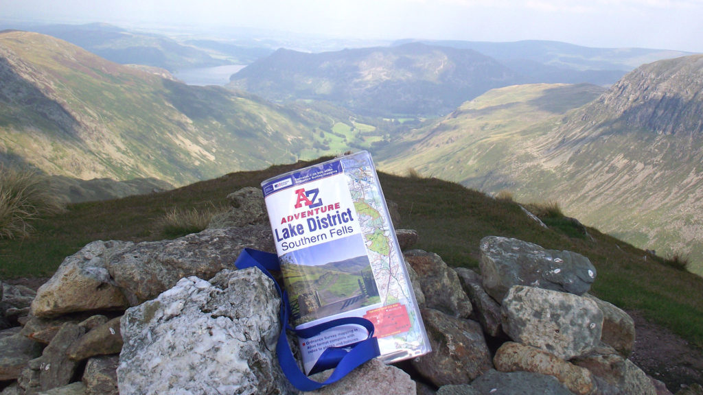
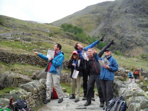
 As we get back to Esk Hause the sun finally comes out revealing the Eskdale Valley in all its beauty. Mark ‘David Bailey’ McConnell, ever looking for that great photo opportunity takes 5 attempts to position the camera and set the timer to get all of us plus the sprawling valley in shot. Needless to say we had many photos of some ‘interesting’ rocks. Further down the path we get some sensible group shots with the map book, after all it is a work trip!
 We’re all down by 11:30am and quickly pack the cars, stretch and in some cases strip off. Just as we’re doing this Mark hands a map book to a father and son team looking a little lost and intending on hitting the summit. After turning them around and explaining the best route to them they’re off and so are we, down to North Wales. We’re staying at The Premier Inn at Caernarfon and once again the talk turns to who’s going to be sharing a room with whom. But this proves to be slightly premature…
Best laid plans!
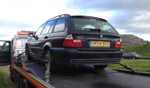
Not long after Tim had stepped up to do his first stint of driving for the weekend he utters the words you really don’t want to hear as you’re cruising along the M6; ‘that’s not supposed to do that’. 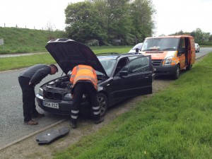 The car loses all power and is soon drifting down the motorway. He quickly guides the car off at the next junction for it to come to a complete halt on the slip road, things don’t look good. The recovery man arrives and soon there are more bits of engine on the roadside than under the bonnet. Litres of fuel are gushing out from lots of places it really shouldn’t be. It doesn’t look like we’re getting to Wales!
Stranded somewhere in North Yorkshire Matt, Andy, Tim and Kieran are facing the prospect of a long transfer home and only completing two of the three peaks as it doesn’t look like the car is going to move another inch. Even with the recovery man referring to the problem under the bonnet as an issue with the ‘enginey thing’ no-one can raise a smile.
The other members of the team soon arrive and it’s decision time. Do we finish our Three Peaks challenge as a group here, or does one car bravely carry on to the finish? After a long debate we decide that it’s
right for one car to carry on and also squeeze one other person into the one remaining car that works. Tim, Matt and Kieran reluctantly choose to stay with the stricken car which by now is in kit form; Andy meanwhile wastes no time in jumping ship. Before anyone can mutter ‘splitter’ he’s grabbed his stuff and wedged himself in the back between Sharon and Hayley.
Morale among the remaining 5 takes a slight dip now that the team has been broken up and only half are due to finish, but this is short-lived. As soon as Mark, Steve, Sharon, Hayley and now Andy arrive at their hotel, showered and eaten, all thoughts of the others stuck in a transport depot somewhere in Blackpool disappear.
Day Four – Snowdon (Yr Wyddfa), the last peak in our Three Peaks challenge
Starting height: 360 metres above sea level
Car park grid reference: SH647555
A-Z Map reference: 2E 33 (4B 68)
Start time: 6:30am
So only 5 people make it to the Pen-y-pass car park at the foot of Wales’ highest peak to take on Snowdon, the last of the 3 Peaks. The others had last been heard arguing over the last KFC in Warwick services just a few hours before. But never mind them, this was now all about the remaining 5 and the completion of an eventful 3 Peaks challenge.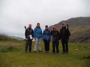
 And so, after another early start, the weary but rested remainder leave the car park and head out along the Pyg track. Be careful here, there are a couple of footpaths out of this car park. The Miners track is an easy-going flat path that winds around the Llyn-Llydaw Lake but has a nasty sting in its tail when it eventually climbs back up to join the Pyg track. The Pyg in comparison is a steady climb the whole way.
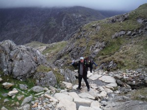
The classic shape of Snowdon is hidden from view at this point, firstly by the ridge of Crib Goch and then by the low cloud which is still to move away. We head up the un-even rocky staircase which is a bit of a shock to the system this early in the morning, discarding expensive clothing garments as we go and soon we pop up over a ridge and the magnificent bowl-like terrain confronts us with Llyn Llydaw at the base. We turn right here along the fence line but are careful not to choose the sty immediately to our right. Cross this and you’re on Crib Goch, a knife-edged arête leading up to Snowdon’s summit – another day!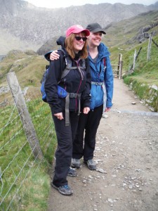
 Our path runs flat for a short while before the ascent begins again, all the while skirting around the perimeter of the great ‘bowl’. There a few hands-on moments as we scramble over large slabs of rock that protrude out of the side of the cliff but apart from that, this path is fairly routine. Soon our path and the top of the Miners track meet and we gaze down to the foot of this path, glad about the choice we’d made.
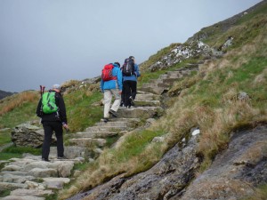 Next up we hit some zig-zags which usually mean things are getting steeper. And they were! However, after about 3 or 4 turns we get up to the Snowdon Finger Stone, a monolith stone that stands erect at what feels like the summit, but it’s not. In fact the flat ground that we’re now on gently rises up to our left and we see the summit atop a professional made cairn sitting just in front of the stone clad building which houses the gift shop and coffee house, Sharon and Hayley are now happy! The smell of diesel hits us and we realise that we’re no longer walking on the path but have strayed onto the train track instead. The Snowdon railway which chugs its way up the side of the mountain gives people who aren’t able to walk up themselves, a chance to be on top of the highest peak in Wales but it’s too early in the day for visitors. We follow the path and then up the steps that wrap themselves around the cairn which now feel like the hardest part of the walk so far, did it need to be made this high?
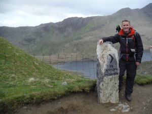
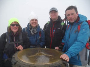 We get to the top at 9:00am and again there’s not too much to see but never mind. We’ve done it, 3 peaks in 3 days. Just time for a quick photo, touch the summit trig point and it’s time to go. We head back to the Finger Stone, turn right into the zig-zags and soon we’re back to the junction with the Miners track. Be careful not to miss the sign as Mark did saying he’d seen something ‘interesting’ in the distance. Once on it the path descends quickly down to Glaslyn Lake, where it would be rude not to skim a few stones in the crystal clear water. Once at the bottom the miners track is an easy walk beside the 2 lakes back to the car park. Finished! We’re back to the car by 11am, the car park is full and the queue for the toilet is around the building. For the last time we consign all manner of walking gear to the back of the car and head for home.
 So really this is how the trip ended for our two groups, one stuck on the hard shoulder of the M6 somewhere in North Yorkshire and the other celebrating a great achievement at the top of Wales’ highest point and summiting the final of the Three Peaks.
If you’re looking for an achievable adventure that’s both challenging and enjoyable and don’t mind the odd mile or two sitting in a car then you can’t go far wrong with this. Nothing wrong with doing it in 24 hours, this is just slightly more fun.
Here’s a few things we’d recommend for your own Three Peaks challenge:

- Use our National Three Peaks A-Z Adventure map book and map case
- Get some decent hill walking gear
- Have a relatively good personal fitness
- Get some earplugs
- Have a bit of knowledge about navigation and bad weather walking
- Eat Jelly Babies
- Leave early and avoid the crowds
- Get some decent breakdown cover!
Good Luck!
Competition
Here’s another another quick competition for you. We’re giving you the chance to win any one of our A-Z Adventure Atlases. All you need to do is answer this question:
What is the total straight line distance, to the nearest mile, between Ben Nevis, Scafell Pike and Snowdon?
Enter by posting a comment below or by sending us a Direct Message (using Facebook or Twitter). The closing date for entries is Monday 29th February 2016. Please see full competition terms and conditions below.
Terms and conditions
- This competition runs until midnight on 29th February 2016. Entries received after that time will not be accepted.
- How to enter:
- Only one entry will be accepted per person.
- Winner(s) will be chosen at random and announced by A-Z staff on 1st March 2016. Their decision is final.
- The winner(s) will receive an A-Z Adventure Atlas of their choice.
- No purchase is necessary to enter or win a prize.
- This competition is open to UK residents over the age of 18 only.
- The name(s) of the winner(s) will be published on our Facebook page and/or Twitter feed and this blog page after being chosen. If you are chosen as a winner, you’ll need to Direct Message (using Facebook or Twitter) or email us your postal address to claim your prize.